It is one thing to think about conquering the heights and a whole other dimension to actually get ready for a mountain climbing trip. Don’t be caught off guard, on top of world’s summits, realizing you’ve just forgot a handkerchief… Like seriously! Here’s a list of important things to bring on your next climbing trip.
For the head and face
Pile or Wool hat:
Bring one that covers ears — a balaclava type is excellent.
Shade Hat: Visor
hats with good brims are essential for protection from the equatorial sun.
Sunglasses: Essential
for eye protection in the tropics and at altitude. Bring a good quality pair,
preferably with an IREX protection rating of 100. Attachable side shields are
necessary, or bring glacier glasses.
Sunscreen: Bring
plenty of complete sun block with a sun protection factor (SPF) of 15 or more.
Unless you have spent time in equatorial sun you will probably underestimate
the amount necessary, so bring lots. Sunscreen is difficult to find in
Tanzania.
Lip Balm: With
SPF rating of 15 or higher.
Bandanas: Tied around the neck, they give good sun protection. Can also be used for cleaning glasses, as wash cloths, etc. They dry very quickly.
For the upper body
T- Shirts: Two T-
shirts that you don¹t mind getting dirty while on the mountain. Synthetic is
best — no cotton on summit day.
Upper Body Layers:
For climbing the mountain we recommend you have three warm layers for the upper
body. Items must be made of wool, synthetic or pile. Make sure all layers fit
comfortably over each other and supply good insulation. A good combination is a
long underwear top, a sweater, and a pile jacket or heavy wool shirt. Cotton
items do not provide adequate insulation and are completely
useless when damp.
Rain Parka: Afternoon
showers are common in East Africa, especially on the mountain. Bring a good
parka of Gore- Tex or waterproof nylon that has been “seam sealed”.
Wind Shirt: (optional
if you have Gore- Tex rain gear) A nylon wind shell (not waterproof), roomy
enough to fit comfortably over all upper body layers. Gore- Tex is good for
both this wind shirt and for the rain coat.
Poncho: (Optional)
Quick and handy protection for body and rucksack. Poor protection in windy
rain.
Gloves or Mittens: Wool
or pile. One pair of heavy mittens and a light pair of gloves work well.
Mitten Shells:
One pair to go over your mittens. These are for use against the winds sometimes
encountered in the crater and on the way to the summit.
For the legs
Quick Dry Hiking
Shorts: 1 pair. Good for hiking at lower elevations on the mountain.
Long Underwear
Bottoms: One pair. Wool or synthetic.
Wool, Bunting or Pile
Pants: One pair that fit loosely and is comfortable. These are essential to
be worn over the long john bottoms.
Rain Pants: Bring
a good pair of rain pants of Gore- Tex or waterproof nylon that has been “seam
sealed”.
Wind Pants: (optional
if you have Gore- Tex rain pants.) One pair. These are used often on the
mountain for protection against wind. They should be breathable nylon and roomy
enough to fit comfortably over wool or pile pants.
Tights: Lycra
types are best. These are comfortable to hike in, help prevent nettle stings,
provide good warmth on cool misty days, dry fast and prevent sunburn.
Undergarments: Enough
for the duration of the trek.
For the feet
Thin Socks: Two
pair of synthetic socks to wear under heavy wool socks. These help prevent
blisters and keep feet dry.
Thick Socks: Six
pair of heavy wool or synthetic socks to wear for warmth with hiking boots.
Hiking Boots: One
pair medium weight hiking boots large enough to be comfortable with one liner
sock and one heavy wool or synthetic sock.
Gaiters: One pair
of either high or low gaiters made of breathable material to keep dirt and snow
out of your boots.
Tevas, Sandles:
These are to wear in camp after a day of hiking.
For sleeping
Sleeping Bag and
Stuff Sac: On the mountain temperatures can get down to zero degrees
Fahrenheit at night so bring a warm bag.
Sleeping pad: A
closed cell foam camping mattress is OK. An inflatable Thermal Rest type is
more comfortable.
FOR DRINKING:
Water Bottle: Two,
one liter wide- mouthed plastic bottles.
Water Treatment:
This is very important. The water in East Africa is not unhealthy although its
flora content is different from what you are used to. To keep your system
running normally we recommend you bring two bottles of “Potable Aqua” or “Polar
Pure”, crystal iodine in a bottle, to treat drinking water. Filtration pumps
are also effective, but costly and rather bulky.
Water Flavoring:
Wyle’s lemonade, Tang, Gatorade, etc. These mixes are hard to come by in
Tanzania and make treated water taste much better. Double bag these.
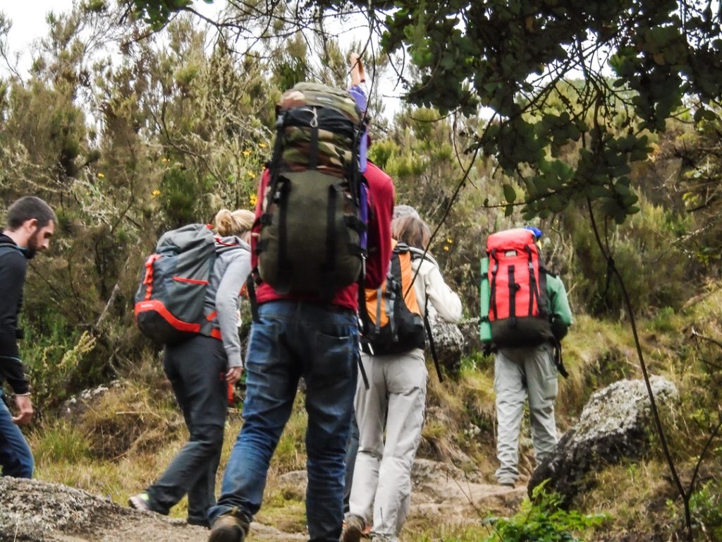
For carrying your gear
Frameless Pack: A
medium size comfortable pack is adequate to carry personal gear. The pack
should fit properly and have a good waist belt. Side pockets are recommended
for soft packs. Personal loads with camera gear, water for the day and warm
clothes are often between 18 and 25 pounds.
Pack Cover: Something
waterproof to cover your pack when hiking in the rain. Otherwise bring a large
plastic bag to line the inside.
Duffle Bag:
Medium size with lock for mountain gear. This will go into our mountain bag
that the porters will carry.
Duffle Bag: Large
enough to hold your non- mountain gear. This will meet you at the hotel after
the climb.
Plastic Bags:
Several, to double bag your sleeping bag and clothes on the mountain. It can
rain every afternoon.
For Personal health and comfort
Toiletries: Bring
enough for entire trip. Keep simple and light. Few toiletries are available in
Tanzania, however, so bring enough for all your needs.
Ear Plugs: To
block out snoring and hut noise, to insure peaceful rest.
Flashlight and/or
Headlamp: Important on summit day and just plain handy in camp. Plenty of
batteries.
Pocket Knife: Simple
Swiss Army type with scissors.
Personal First Aid
and drug Kit: Please see recommended list below.
Trail Munchies:
Although plenty of snack food is provided, trekkers like that taste of home in
their pack. Touted as an important accessory by those who have brought them in
the past!
Hot Drink Mixes:
We will provide plenty of coffee, cocoa and tea, but non- caffeinated drinks
are not readily available here. Bring a supply of your favorite herbal teas.
Towel: For
washing up in camp, a small one is fine, or you can use a bandana.
Towelettes: Such
as “Wash’n’Dries” for general hygiene.
Spare Glasses:
For contact wearers in dusty conditions and any eyeglass wearer while on vacation.
Umbrella: Very useful against rain and sun. Most guides use one
ALT 2356M/7730FT Mt. Suswa is only 50kms from Nairobi and is described by many as the best day hike from Kenya Capital,this little known yet Massive cratered Volcano is located very close to its well known Sister Mt. Longonot. Mt.Suswa is one of the most spectacular mountains of the Rift Valley as it comprises a 12kms across double crater system,a vast network of obsidian caves and a variety of wild animals and plants. Mt. Suswa is a magnificent extinct Volcano in the Rift Valley.It is famous for its many caves on its E slopes.The inner crater is a home for a variety of snakes species.Other wildlife of interest found on or near Mt. Suswa includes Zebra,Giraffes,Mongoose,Turtles,Hyenas and Leopards.
All these caves are easy to access,none are too long or complex and no special skills to explore this system
Trip Itinerary: We usually depart Nairobi for Mt. Suswa at 6:00am,expected time of arrival is 08:30am,here we start hiking, Bird watching and sites seeing.At 1;00am we take our picnic lunch at one of the caves enroute to the Summit/Mt. Suswa camp.relax at the peak as we photograph and we start descending as we enjoy Game watching. We usually leave this place around 4;00pm and back to Nairobi.
Rates:(Depends with the number of participants) and includes:
• This includes,
• Packed lunch
• Transport
• Conservancy fee
• Guide fee
• N/B.
It is important to carry water,picnic lunch and high energy snacks and also good hiking equipments for a successful hike.
Hiking to the top of the Great Rift Valley will give you the chance to experience the freedom and awesome wilderness of East Africa, and still be home in time for dinner. Mt Longonot is just less than 2780m (9100ft) above sea level with a tree-filled interior and a lonesome steam vent to the northeast. A climb up Mount Longonot is an ideal day trip from either Nairobi or Naivasha.
The trip departs Nairobi at 8am and the journey takes approximately 1 and a half hours. Your start the ascent at 2150m and, like all good uphill hikes, it will lull you into a false sense of security with a slow gentle rise to the first hill. This gives you a chance to get your lungs and limbs freed up for the second section which, in our opinion, is most awesome. At the end of each section there is a rest point where you can prepare yourself for the next part of your journey.
Despite setting off early to avoid the heat of the sun, by the time you reach the end of the second section you will have surely generated your own heat.This hike is not an easy hike but is achievable by people of reasonably good fitness. Once you have finished the second section, you are on the rim of the crater. There is another respite of slightly less demanding terrain, before making the final climb on the fourth section. This again is a demanding section, though not as demanding as the second. As you heave yourself over the rim of the crater you are rewarded with the awesome sight of Naivasha and the Great Rift Valley and a feeling that it was all worthwhile.
NB: Before making this climb you will need to acclimatise at 6000 feet. A ranger accompanies you on the hike as your guide. As there are wild animals in the area, he is armed. The whole trek is only about 8–9 km long but very steep, so much so that the round trip from park gate to the Longonot Peak and back again takes around 5 hours of hiking.
Mount Kinangop (or Ilkinangop) is a mountain in the southern Aberdare Range about 100 miles (160 km) north of Nairobi, Kenya. It is within the Aberdare National Park.
A dormant volcano, Kinangop overlooks the Kinangop Plateau to the west and the Great Rift Valley beyond.Kinangop is the second-highest mountain in the Aberdares after Mount Satima.The lower levels of the mountain have extensive bamboo forests. Higher up it is covered by tussock grasses.
The main peak is a rocky outcrop surrounded by open moorlands. Due to the height, temperatures are cool and may drop below freezing at night.The breathtaking beauty of the Aberdares southern moorlands awaits those who go trekking from Njabini to Kinangop peak past the Elephant Hill.
This is probably the steepest trail on the Aberdares range, with an elevation gain of over 1,700m.The trail for this hike starts from Njabini Forest Station at an altitude of about 2,500m above sea level. It traces the Elephant Hill hiking trail all the way to its summit (3,600m asl), before descending sharply for about 200m onto the moorlands that characterize most of the Aberdares mountain range above the tree line.
You need to be reasonably fit to do this climb. The Elephant Hill on the southern end of the Aberdares Ranges, about 90km north of Nairobi, is an ideal location for a day hike especially if you’re preparing for the more challenging Mt Kenya or Mt Kilimanjaro climbs. The Aberdares Ranges are situated west of Mt Kenya in the central highlands between Nyeri and Naivasha, and stretch 70km long from North to South.
Distance from Nrb: About 90km Starting Point: Njabini Forest Gate Ending point: Njabini Forest Gate Walking Duration: 7 hours Terrain: Dirt road leading to swampy trail in the bamboo zone, before turning rocky in the alpine zone. Difficulty: Moderate to High.
The Aberdares are the water catchment area feeding two of the largest dams supplying over 95% of Nairobi needs, i.e. Ndakaini Dam in the Thika region and Sasumua Dam near Njabini town. The Aberdares slopes are also one of the major bread baskets for vegetables supplied to Nairobi groceries, and possibly the most significant source of the second most important staple food consumed in Nairobi, the Irish potato.
Route Description Although the hill can be ascended from various starting points, the best approach is the Njabini Forest Station (former Kinangop South Forest Station), about 4kms from Njabini shopping centre. The hike up the hill takes 3 to 4 hours after starting at an altitude of 2600m at the Forest Station. The first few kilometers are over relatively flat forest covered terrain, with the occasional herd of cattle grazing the glades in the forest a testament to the growing push by human settlements into the receding forest boundary.
On ascending further up, the forest gives way to the Bamboo zone. The narrow trail, punctuated every few steps by treacherous mud, at this point is covered by a canopy of towering bamboo with the filtered light enhancing the jungle feel as you continue trudging up the now steeper path. The occasional elephant footprint droppings from various animal species are a constant reminder that you are in a game reserve teeming with wildlife, with the armed escort your only shield from possible danger. After what seems like hours of plodding though the muck and fighting the urge to just throw in the towel and turn around, the trail finally levels off and the Bamboo thins out as you get to the alpine zone, characterized by the stunning array of outlandish flora like lobelia, Senecio, Tussock grass, giant heather among others, a real feast for botany enthusiasts. Amazing views of the surrounding countryside including the nearby Sasumua Dam down below to your right, and the distant Ndakaini Dam to your left, awaits those who make it this far. You are now at the elephant’s rump, also known as the “point of despair”.
For those strong enough to continue, the rest of the hike goes over slightly rocky terrain at an altitude of over 3500m above sea level, with the temperature dropping significantly, as you pick you way across the elephant’s back. The trail first descents into a clamp of trees before turning back upwards out of the small valley. It then gets pretty steep as it meanders past gnarled giant heather trees adorned with Spanish moss offering handholds when you need to pull yourself up the slope. Mercifully it soon levels off to give you your first view of the summit. You’ll recognize it by the saddle between two knolls, with the summit to the right. Kinangop, the second highest peak on the Aberdares, can easily be accessed from this point. The descent is just as trying as the ascent, taking a big toll on the knees, and another 3 to 4 hours to the Forest station.
Requirements
Visitors are required to be accompanied by armed escort from the Forest Gate
Hiking equipment/Rain gears
Identification documents for the park entry. Packed lunch from Nairobi
Tour is a full day trip to climb Menengai crater. Menengai crater is located 10 kilometers (6 miles) north of Nakuru, the fourth-biggest city in Kenya. The drive from Nairobi to Nakuru takes about 2.5 Hours. It takes another 10 minutes to drive from town to the foot of the crater where the Menengai Forest station offices are located.
Menengai crater is an extinct volcano and one of the
world’s largest intact craters and it is 12 kilometers across and nearly 500
meter deep in places. The crater floor covers nearly 90 square kilometers.
While standing at the rim of the huge crater, one is able
to have the view of the large stretch of the Northern Rift Valley in a
panoramic view, having a glance at some of the mountains like the Tugen Hills,
Mau, Aberdares, Mathews Range, the Cherenganyi and the Elgeyo-Marakwet
escarpment.
More striking is the fact that at the crater, one is able
to have the beautiful view of Lake Bogoria, Lake Nakuru and the beauty of the
crater itself. The hike takes approximate 4 to 5 hours walk from the base of
the crater to the rim and back.
Menengai Crater Nakuru 1 Day Hiking Tour hike begins down
hill to the floor of the crater, a flat stretch, then a rocky, grassy uphill to
the summit. It is a pleasant trip with breathtaking views into the crater as
well as surrounding parts of the Rift Valley.
Various bird species as well as hyenas, baboons and dik
dik can be spotted at the crater. The descent down the crater looks pretty
easy. However, it is the long trek upwards that is torturous. You need to be an
expert hiker to conquer it!
With its amazing scenery, Menengai crater is indeed one of
the most attractive places in the Rift Valley. The hiking, trekking, camping
and picnicking options available to the visitor offer the promise of a
rewarding trip.
There are also caves that can be explored, but they tend
to be frequented by those on religious pilgrimages. Our Menegai Crater Tour
ends in Nairobi at 1900 Hours.
Menengai
Crater Nakuru 1 Day Hiking Tour Itinerary:
0600h
rs: Pick up from Racecourse as usual
and depart for Menengai crater, Nakuru County
0800
Hrs: Stop Over at the View Point
0930 Hrs: Arrival at the Menengai
Forest station Gate
1030Hrs: Begin hiking (approximate 4-5 hours) Hike is hard and
challenging. You must be fit to finish the whole hike
1230
Hrs: Enjoy Packed Lunch box
1530Hrs: Begin your journey back to Nairobi
0630
Hrs: Arrival in Nairobi with fond
Memories to Cherish for